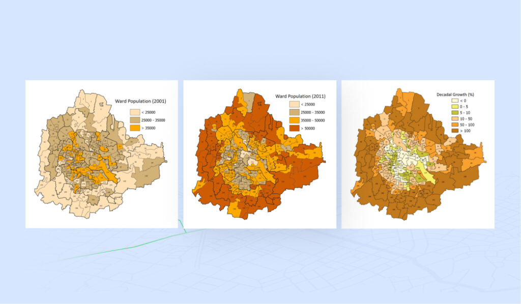
Demographic Changes in Bengaluru Over the Decade
Bengaluru City has experienced rapid development, with a population growth exceeding 44% between 2001 and 2011. However, this growth has been unevenly distributed across the city. To ensure a more even population distribution within the jurisdiction of the Bruhat Bengaluru Mahanagara Palike (BBMP), Ward Delimitation became necessary.
The Census 2011 Enumeration Blocks were incorporated into the city’s GIS environment, and a systematic spatial analysis of the population was conducted. Ward boundaries were established in strict compliance with the relevant legislation and guidelines provided by the Government of Karnataka.
These wards were delimited in a manner that aligns their boundaries with the respective Assembly Constituencies in the BBMP area. Key parameters considered for defining and drawing ward boundaries included the population within each ward, the geographical area of the corresponding Assembly Constituency, neighborhood contiguity, the use of permanent infrastructure as natural boundaries, the management of municipal functions and services, as well as administrative convenience.
Delimitation of Wards in Bruhat Bengaluru Mahanagara Palike (BBMP)