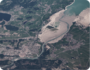
Transformation
PIXEL's commitment to digital transformation is evident in our innovative approaches, ensuring that clients stay at the forefront of geospatial advancements.
Transformation
PIXEL's commitment to digital transformation is evident in our innovative approaches, ensuring that clients stay at the forefront of geospatial advancements.

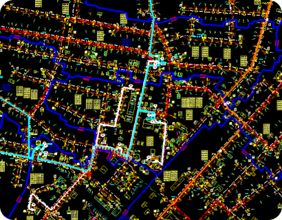
Technology
PIXEL is committed in pushing the boundaries by harnessing state-of-the-art technologies in its Geospatial Consulting, Services and Solutions.

Trust
PIXEL, an ISO 9001, ISMS 27001 and CMMI Level 3 certified company has evolved as a trusted partner for Geospatial Consulting, Services and Solutions helping its clients navigate complex spatial landscapes while upholding a steadfast commitment to trustworthiness and accountability.